Explore the Biodiversity of the Klamath Mountains

Bigfoot Trail

Cart

  • Route
    • Maps and Guidebook
    • Trail Regions
      • 1 – Yolla Bolly
      • 2 – Trinity River Country
      • 3 – Trinity Alps
      • 4 – Russian Wilderness
      • 5 -Marble Mountain Wilderness
      • 6 – Red Buttes
      • 7 – Siskiyous
      • 8 – Redwood Country
    • Trailblazers
    • Interactive Map
    • Media
    • Trail Blogs
  • Blog
  • Support the Trail
    • Personal Memberships
      • Day-Hiker Membership
      • Thru-Hiker Membership
      • Flip-Flop Membership
    • Business Partner
    • Volunteer
    • Donate
    • Leave No Trace
  • Biota
    • Conifer List
    • Plants
    • Birds
  • Our Work
    • Diversity and Equity
    • Board of Directors
      • Contact the BFTA
    • Community Science
    • Bigfoot Trail Youth Stewardship Project
    • Trailwork
    • Media
  • Store
    • Bigfoot Trail Poster
    • Bigfoot Trail Mapset: Printed
    • Bigfoot Trail Mapset: Digital
  • My Account
    • Account details
    • Lost password

Hike to Packers Peak

June 14, 2016 by Michael Kauffmann Leave a Comment

The Bigfoot Trail High-Point

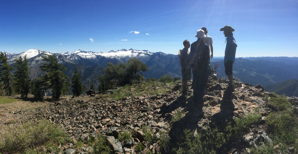
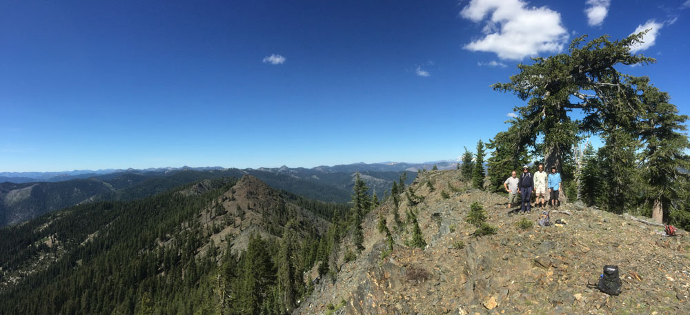
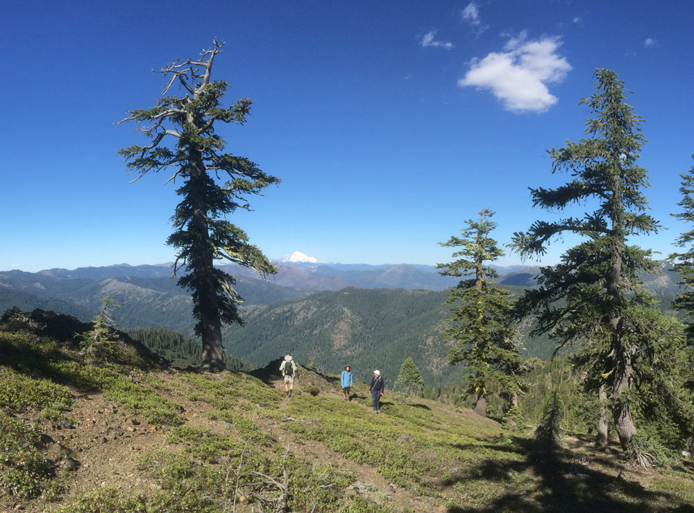
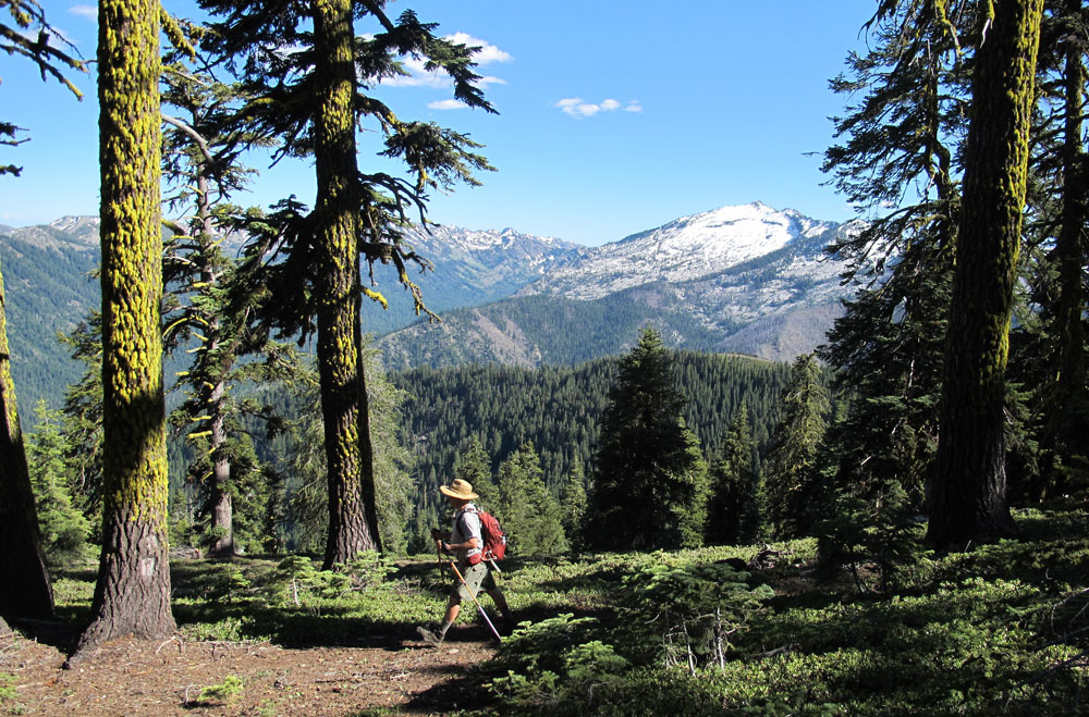
On Sunday, 5 volunteers met up in Coffee Creek, California to summit Packers Peak in the Trinity Alps Wilderness. This is the highest point along the Bigfoot Trail, at 7,822′. The peak offers some of the best views in the Klamath Mountains, amazing conifers, and other rare plants. This effort was spearheaded to collect data on the first photo-monitoring plot for the Citizen Science and Climate Change grant supported by the Rose Foundation.

BFT_9
The route climbs 2,800′ over 2.5 miles.

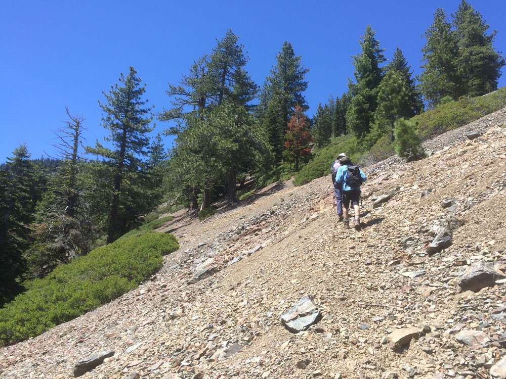
The hike is outstanding and quite strenuous as it climbs about 2,800′ in just over 2.5 miles. The trail is infrequently traveled, so it requires some route-finding in places. But I hope to get out and work on this section next summer.

To learn more and be a part of the Citizen Science and Climate Change experience, follow these links:

  • Citizen Science and Climate Change overview
  • GPX Track for the PackersPeakHike_BFT-HighPoint
  • Trinity Alps high point data page
  • Download a KMZ file of all the high-point monitoring plots
  • Download the Packers-BFT-Data Sheet
Scree-slopes highlight the central portion of the hike. We need to do some work on this part!
Views from the summit to the south, toward the White Alps.
Dramatic vistas to the north including the Russian and Marble Mountain Wilderness
Mount Shasta and foxtail pines.
Hiking the Bigfoot Trail.

Data was collected June 11th, 2016 by:

  • Michael Kauffmann
  • Jeff Morris
  • Andrew Nofsinger
  • Keith McCloghrie
  • Philip Mitchell

Stay tuned for more volunteer opportunities!

Share this:

  • Email

Filed Under: Hiking the Trail, Trinity Alps

Leave your thoughts...Cancel reply

Recent Posts

  • The Bigfoot Trail Ate Me Alive
  • Trinity Alps Trail Work
  • Marble Valley trip #1
  • South Russian Creek Trail
  • Bear Creek Trail, Trinity Alps Wilderness

Socialize

  • Instagram
  • Facebook
  • Twitter

Get Email Updates

* indicates required
 

Donate

Help our organization by donating today! All donations go directly to making a difference for our cause.

Close×

Subscribe to the BFTA Blog

Enter your email address to subscribe to this blog and stay up to date on the Bigfoot Trail.

Join 109 other subscribers

BFTA is a 501 c3

Tax ID #47-4468143

Contact

email: bfta [at] bigfoottrail.org

PO Box 777, Bayside, CA  95524