
October 2023 Update
All routes and trails are open.
There is some snow on the highest north-facing slopes. Great time to be out!
September 2023 Update
Active fires are all across northwest California right now…most of the trail is closed.
June 2023 Update
Current conditions include regular afternoon thunderstorms, fast moving creeks and rivers, along with snow levels hovering around 5500′.
Consider day hikes in lower elevations as lower daytime temperatures are still trending. Rivers and creeks are still running high.
May 2023 Update
It has been a wild year so far in California. The state is soaking up the rain and snow after years of drought conditions. It is such a relief to have this precipitation but it also means that hiking and trail working seasons will be more difficult, if not delayed, this year.
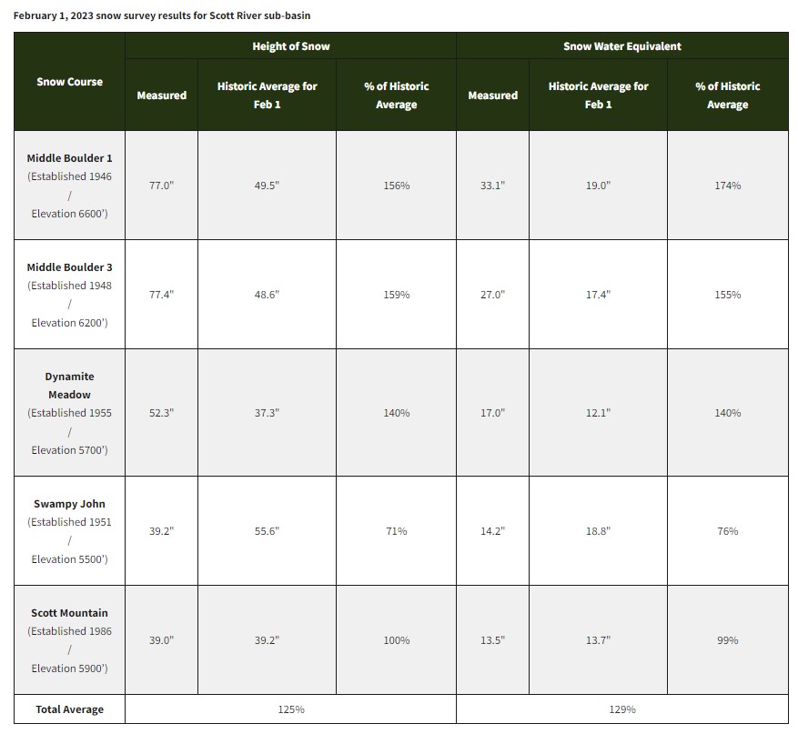
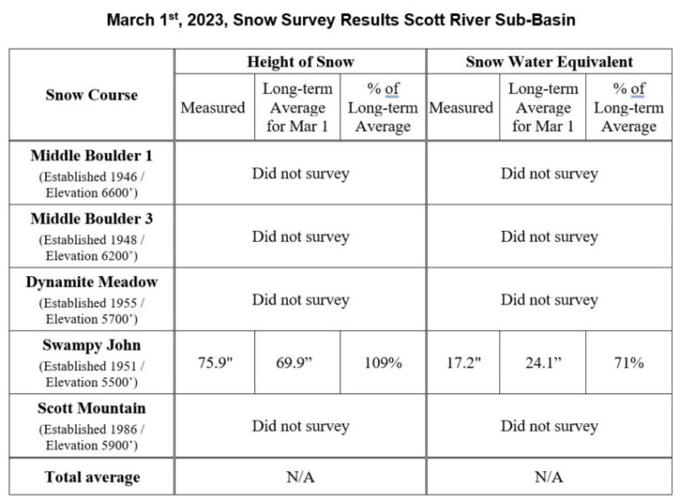
A Look at the data…
The February 1st survey looks really good. Then winter hit us again in February and the surveyors could not even get in for many of the March 1st surveys. Swampy John, the lowest elevation site, was surveyed and holds a low average due to climate change and the rising snow forests. We look forward to seeing the data from April 1st.
Be careful out there
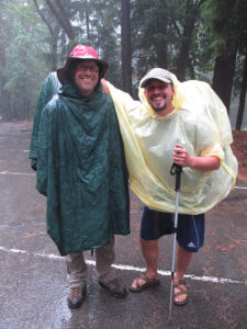
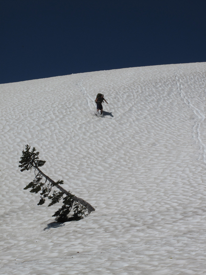
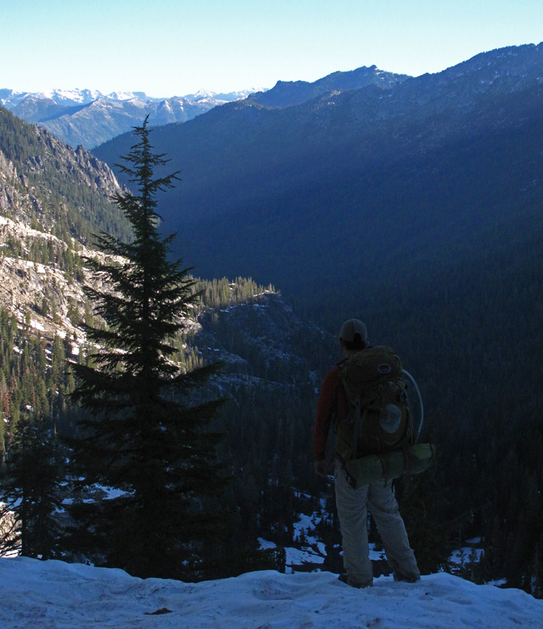
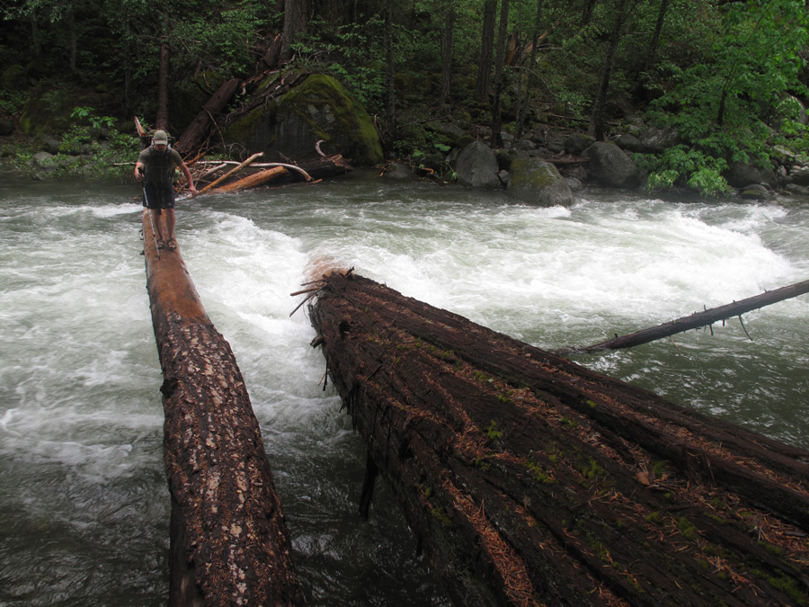
Hiking in the Klamath Mountains is never easy. The trail gains and loses 100,000 feet in elevation. When you add high snowpack and rushing streams and rivers, caution should abound. What follows are pictures from a section hike. We had 5 inches of snow on our June 21st start at Canyon Creek. The streams were raging and worrisome to cross but we eventually hit summer in the Red Buttes, where we ended our hike.
More updates to come…
April 1 snow data is out at https://cdec.water.ca.gov/reportapp/javareports?name=COURSES
Looks like Swampy John is at 132% but Etna Mountain is 171%. (Bighorn Plateau near Mt. Whitney is at 310%!).
I attempted a portion of the Fir Glade Trail in the Red Buttes last week and the amount of snow is overwhelming still.