Explore the Biodiversity of the Klamath Mountains

Bigfoot Trail

Cart

  • Route
    • Maps and Guidebook
    • Trail Regions
      • 1 – Yolla Bolly
      • 2 – Trinity River Country
      • 3 – Trinity Alps
      • 4 – Russian Wilderness
      • 5 -Marble Mountain Wilderness
      • 6 – Red Buttes
      • 7 – Siskiyous
      • 8 – Redwood Country
    • Trailblazers
    • Interactive Map
    • Media
    • Trail Blogs
  • Blog
  • Support the Trail
    • Personal Memberships
      • Day-Hiker Membership
      • Thru-Hiker Membership
      • Flip-Flop Membership
    • Business Partner Membership
    • Donate
    • Volunteer
    • Leave No Trace
  • Biota
    • Conifer List
    • Plants
    • Birds
  • Our Work
    • Bigfoot Trail Youth Stewardship Project
    • Photo Monitoring
      • Siskiyou Wilderness Highpoint
      • Red Buttes Wilderness Highpoint
      • Marble Mountains Highpoint
      • Russian Wilderness Highpoint
      • Trinity Alps Highpoint
      • Yolla Bolly Highpoint
    • Media
    • Contact the BFTA
  • Store
    • Bigfoot Trail Poster
    • Bigfoot Trail Mapset: Printed
    • Bigfoot Trail Mapset: Digital
  • Events
  • Log In
    • Account details
    • Lost password

Section 2 Update

July 5, 2015 by Michael Kauffmann Leave a Comment

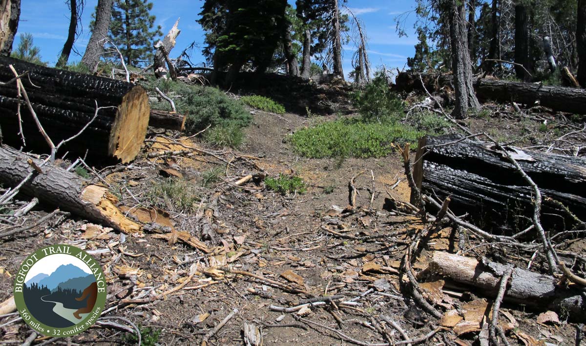
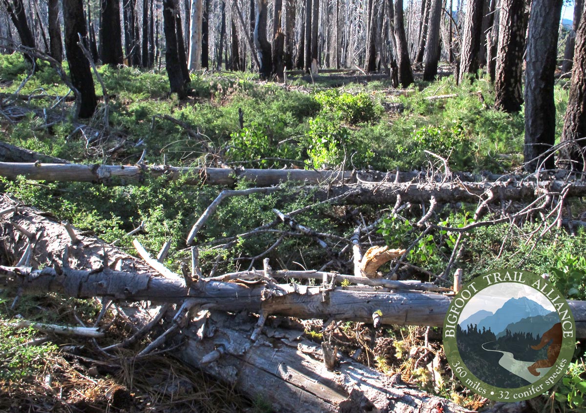
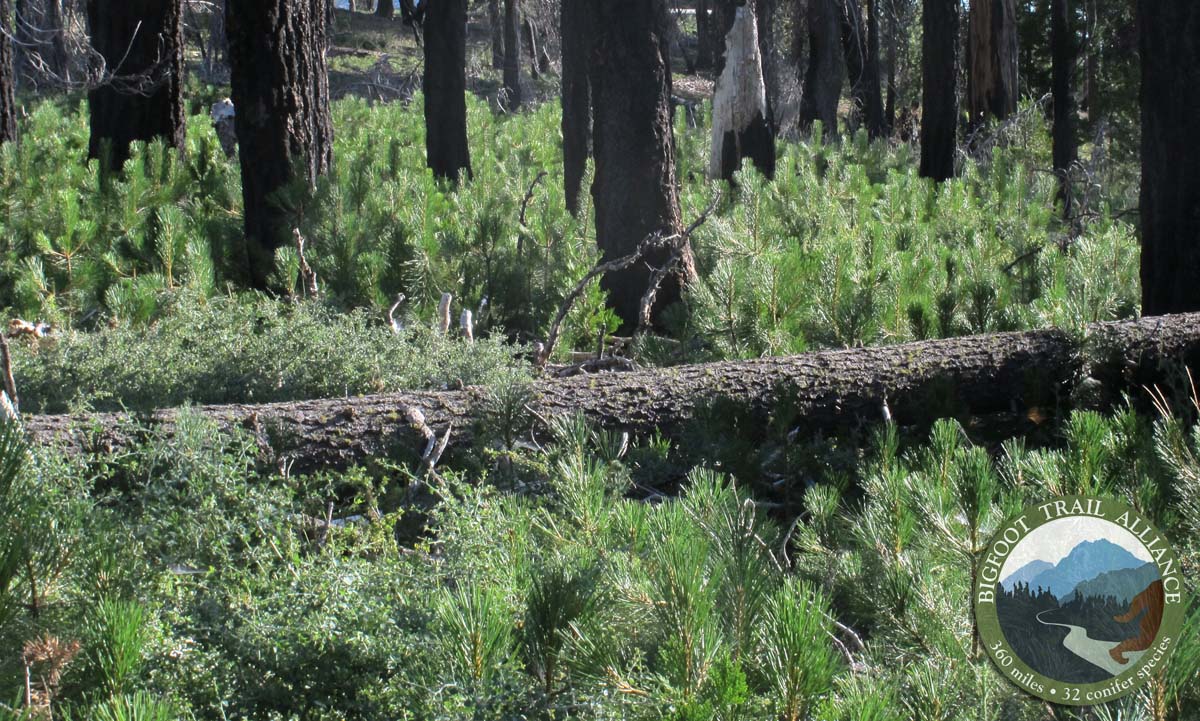
It had been six years since I last walked this stretch of trail. The first time I found myself hear was 10 months removed from a landscape-altering fire. It was more black and white in 2009–with only intact forest and burned forest. In areas where the trail burned, so had the undergrowth. My first hike here was smooth sailing along the Devil’s Hole Ridge–but not in 2015. Ceanothus, manzanita, and an assortment of bunch grasses have, over 6 years, swarmed the understory in a successional race for dominance. Match-stick conglomerations of downed trees cover sections of trail now, having bent and ultimately fallen, with winter winds. This made the trail, in several stretches, nearly impossible to find. I’ve updated the route description to reflect these changes since I first wrote this in 2009. As I slogged along and sliced my shins, I was thankful for my time here, for my experiences of place, for having experienced this landscape in two dynamic phases.

Bigfoot Trail Map Update: Section 2

Last summer it appears the Mendocino worked on stretches of trail in Section 1 but not in the initial stretches of Section 2, while the Shasta-Trinity worked on the trail from Powell Ridge Trial to Devil’s Creek Spring. Inbetween, one must follow the ridge where the trail has disappeared. Working to get these unmaintained stretches in better order will be a primary focus for the Bigfoot Trail Alliance once we have our feet under us and MOUs in place with the Mendocino and Shasta-Trinity National forest.

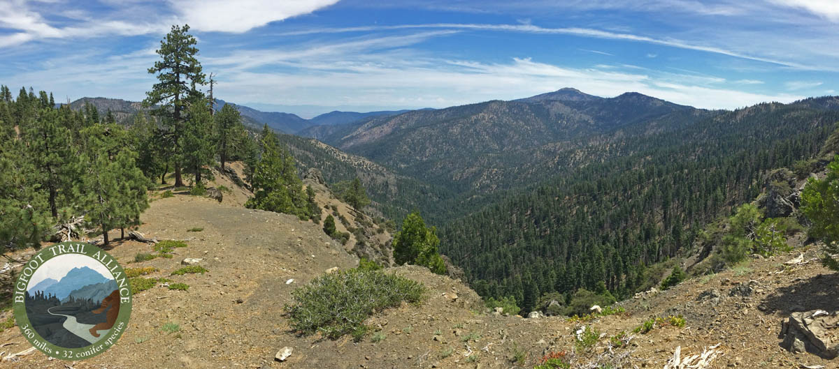
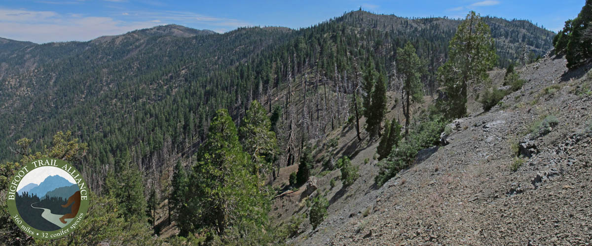
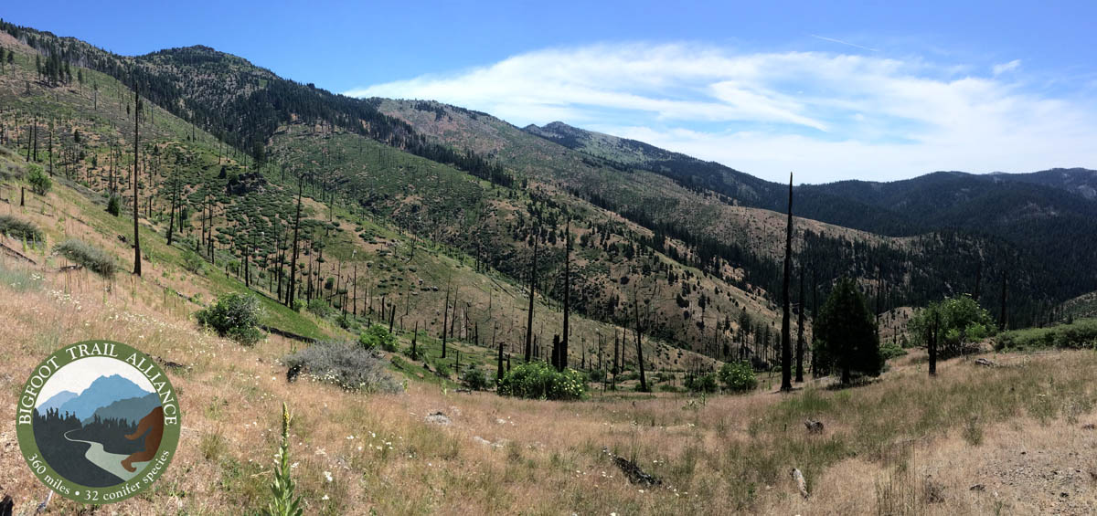
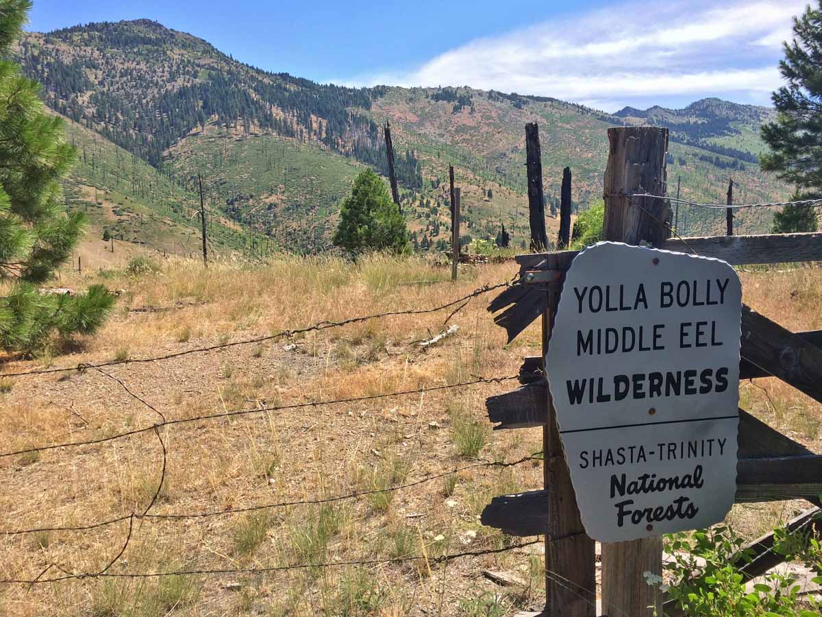
Enjoy the images that follow from section 1 and 2 along the trail.

Just south of the Knob at the end of Section 1.
Just south of the Knob at the end of Section 1, looking toward Mount Linn, where the trail begins.
BFT2
The east-facing exposed stretch of trail directly below The Knob.
Just before Section 2 begins, trail maintenance through the 2008 burn ends.
The Mendocino did nice work at the end of Section 1 down to Frying Pan, but the BFT north of here needs some work.
Trailwork2
Current state of the BFT in the initial miles of Section 2, along the Devil’s Hole Ridge Trail. Brushing and clearing are needed.
Ponderosa pine regeneration ON the Bigfoot Trail.
Ponderosa pine regeneration ON the Bigfoot Trail. Brushing please!
cedar-basin
The end of section 2 at the edge of the Yolla Bolly-Middle Eel Wilderness where a high-intensity burn has permanently altered the landscape.
West-Low-Gap
Looking toward North Yolla Bolly Mountain from the wilderness boundary at West Low Gap.

Read More about the walkabout HERE.

Share this:

  • Tweet
  • Email

Filed Under: Yolla Bolly Section

Leave your thoughts... Cancel reply

Recent Posts

  • BFTA Welcomes 4 New Board Members
  • Looking Back and Looking Forward
  • 2022 Bigfoot Trail Siskiyou Wilderness Collaborative
  • Long Gulch Lake
  • Upper Wooley Creek

Socialize

  • Instagram
  • Facebook
  • Twitter

Get Email Updates

* indicates required
 

Subscribe to the BFTA Blog

Enter your email address to subscribe to this blog and stay up to date on the Bigfoot Trail.

Join 95 other subscribers

BFTA is a 501 c3

Tax ID #47-4468143


Contact

email: bfta [at] bigfoottrail.org

PO Box 777, Bayside, CA  95524